Chuangheng control multi-scene cross-platform ground software solution
2023-01-12 11:47:00
Uav ground software product line
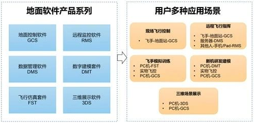
The UAV ground software of our company focuses on the two aspects of "flight control" and "simulation training", and lays out 6 products to achieve "safe" flight support, "powerful" function coverage, and "convenient" user experience.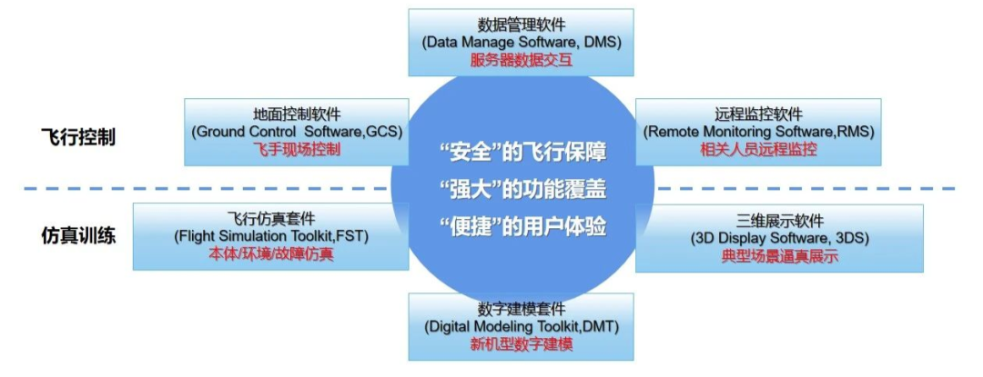
Ground control software
Ground Control System,GCS
After years of iteration and improvement, the GCS40, 50 and 60 model series has been formed, which has a perfect flight protection strategy, supporting multiple aircraft in one station, visible parameter storage, a variety of photoelectric pod control, remote connection control, automatic route planning and other functions.
Flight protection strategy
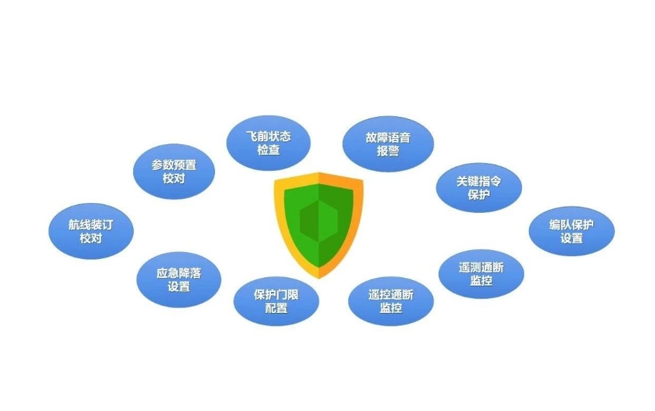
It has 10 flight protection strategies to provide all-round flight safety from pre-flight to in-flight.
Multiple machines at one station
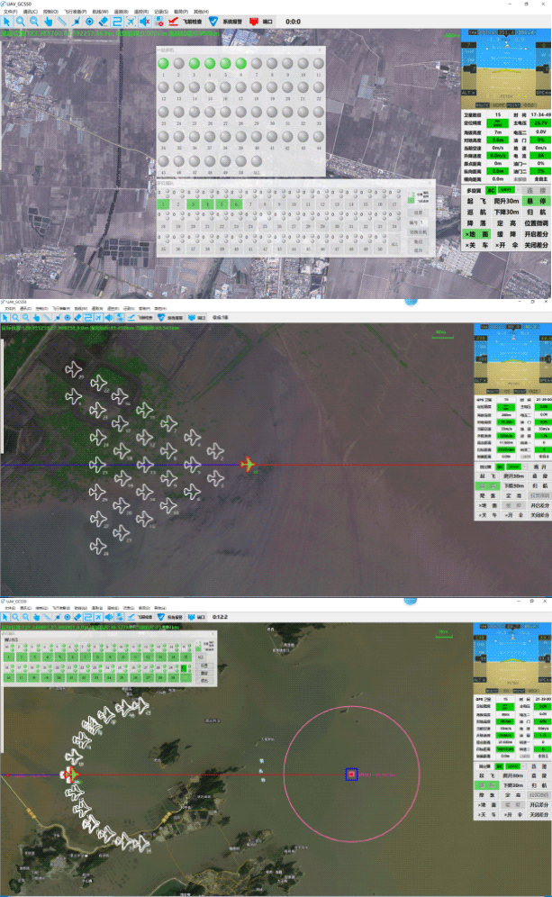
It supports remote control and telemetry of up to 50 aircraft in 1 station, and supports automatic take-off, landing and formation flight of multiple aircraft (triangle, horizontal one shape, vertical one shape, fan).
Visual parameter storage
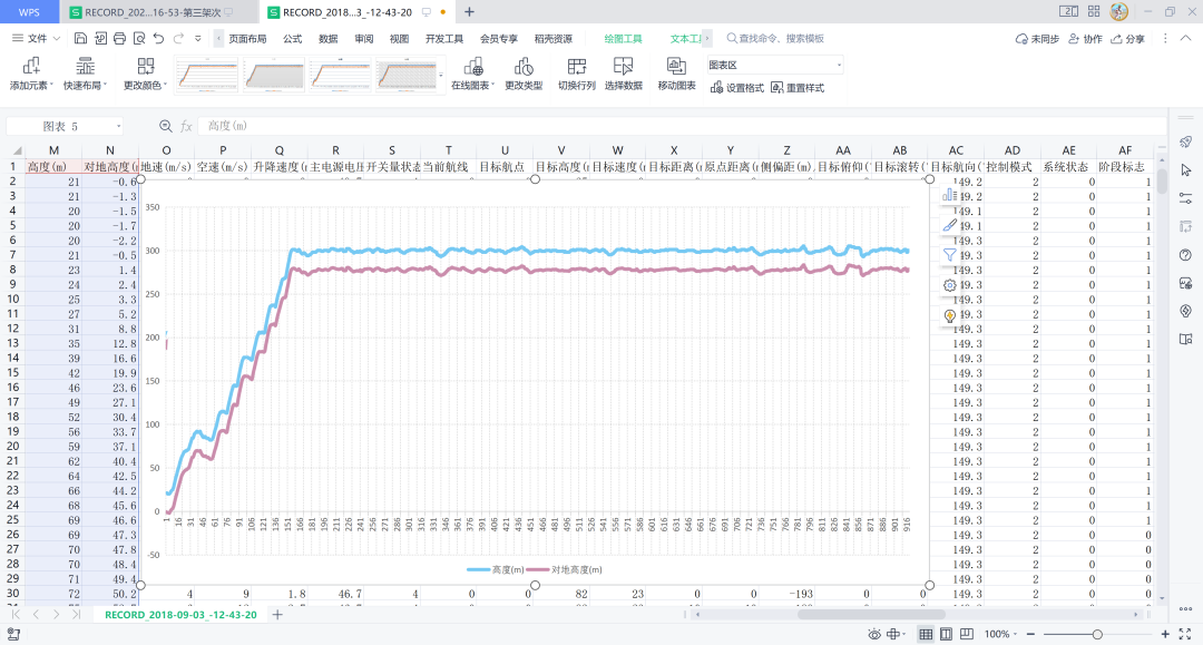
Support source code storage and CSV format telemetry parameter storage. The CSV file can be opened to view telemetry parameters and generate key data graphs for data analysis.
Multi-model photoelectric pod control
Supports more than 10 kinds of photoelectric control protocols, including: Pinling, Haofu, Shangbo, Guanzhong precision instrument, etc., and the general way of transparent forwarding.
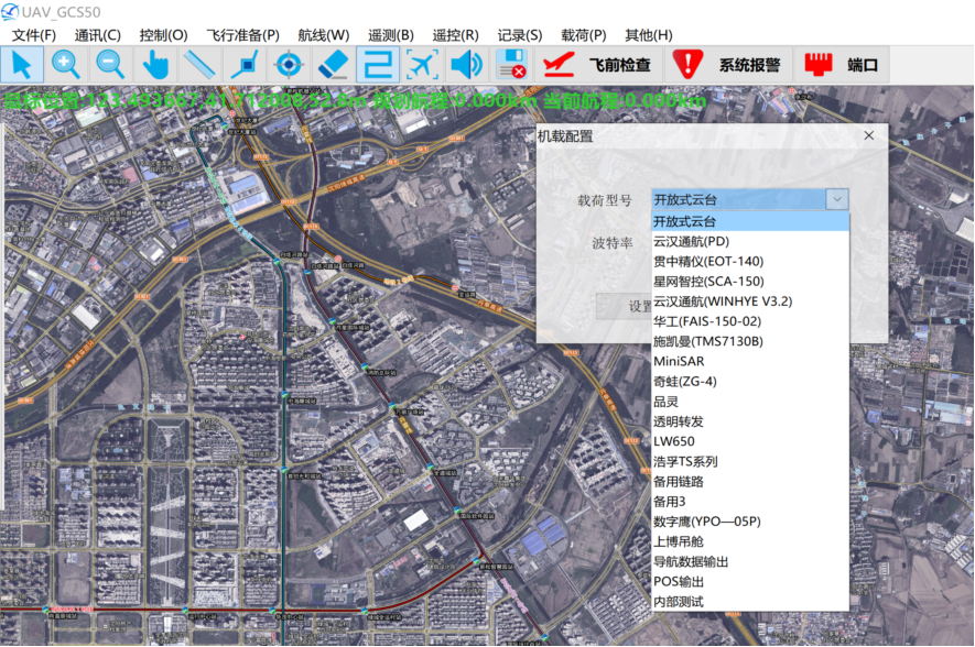
Support pod list
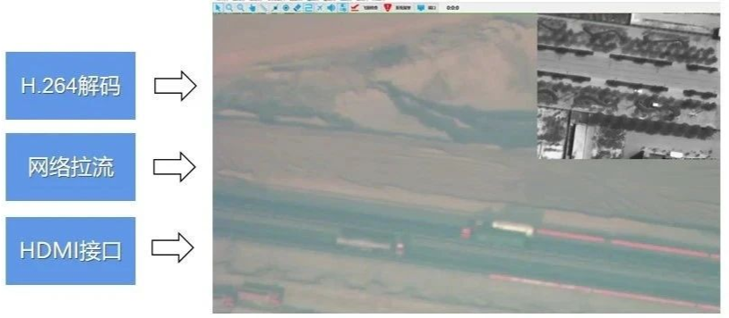
Video data analysis supports single/multi-channel H.264 decoding display, network stream display, HDMI hardware interface display.
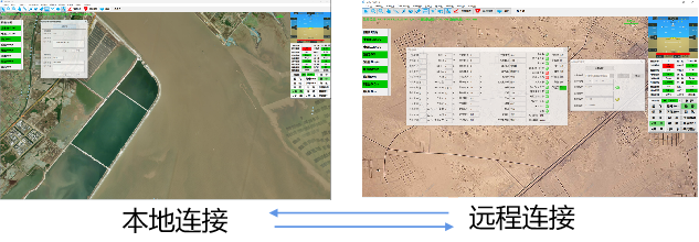
Remote connection control
The mode of "Network TCP connection to remote ground station" is set to realize the flight control mode of "remote GCS software - flight site GCS software - UAV".
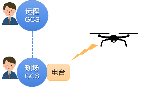
使用方式
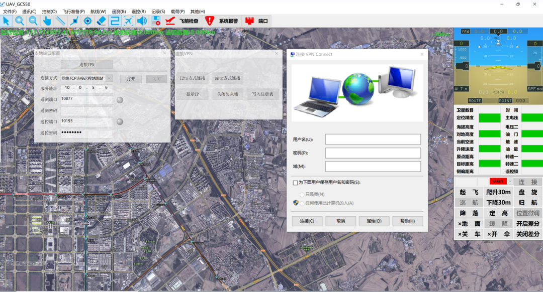
Configure remote connection parameters
Automatic route planning
Support mapping routes (snake, well), patrol routes, takeoff and landing routes automatic planning, built-in camera models, support route parameter calculation, irregular measurement area, turn point insertion, photo point generation and other automatic functions.
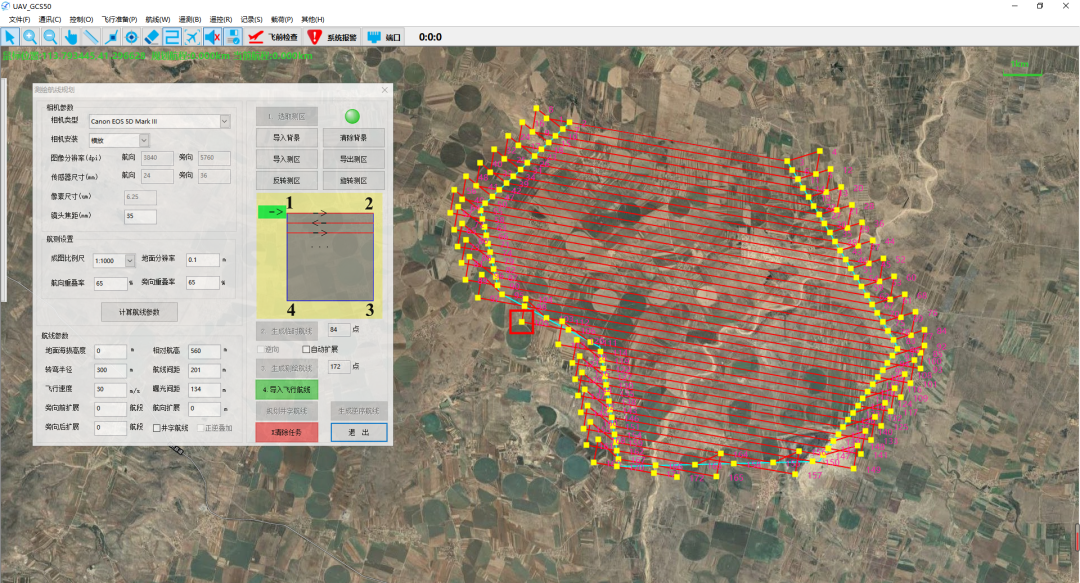
Serpentine course
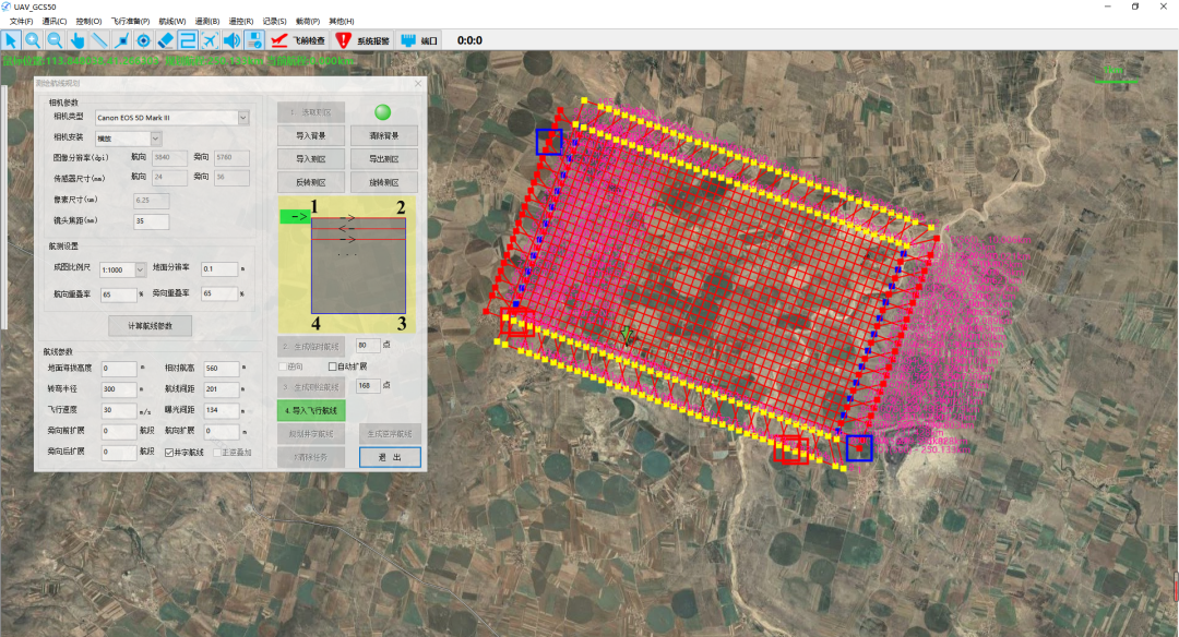
Well course
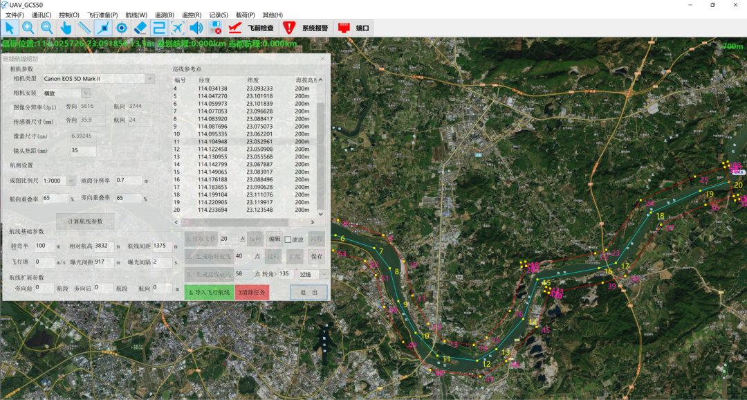
River inspection route
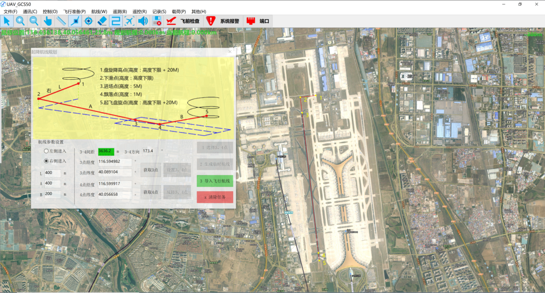
Airport landing route
Cross-platform with new UI design
On the basis of GCS40 and 50, a new generation of cross-platform GCS60 software is launched, supporting Windows, Linux, Android and iOS systems, and the UI is redesigned.
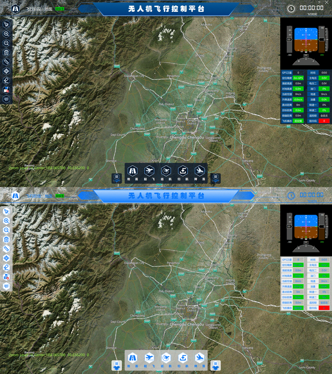
Two styles of UI interface
Mature function transplantation, new interaction design
Remote monitoring software
Remote monitoring software,RMS
Remote control software RCS, applied to the mobile Android and iOS systems, uses the data management software DMS to conduct remote telemetry data interaction with the ground control software GCS50/60, providing users with convenient remote flight monitoring functions. Support user grouping, key remote control, multi-flight node telemetry, multi-user access, etc.
Mode of use
As shown in the figure, RMS, DMS and GCS can be arranged on the Internet to realize the interconnection at any location; It can also be placed on the Intranet to ensure data security while achieving multi-point flight monitoring.
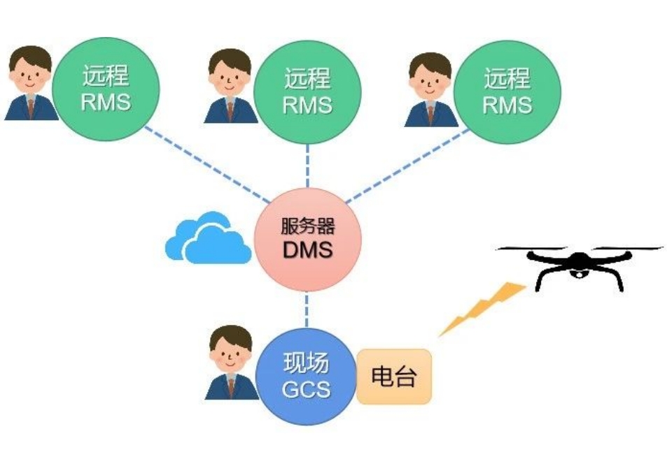
Mode of use
User access verification
Through server address and ground station password verification, multi-user unit grouping and multi-flight site access are realized.
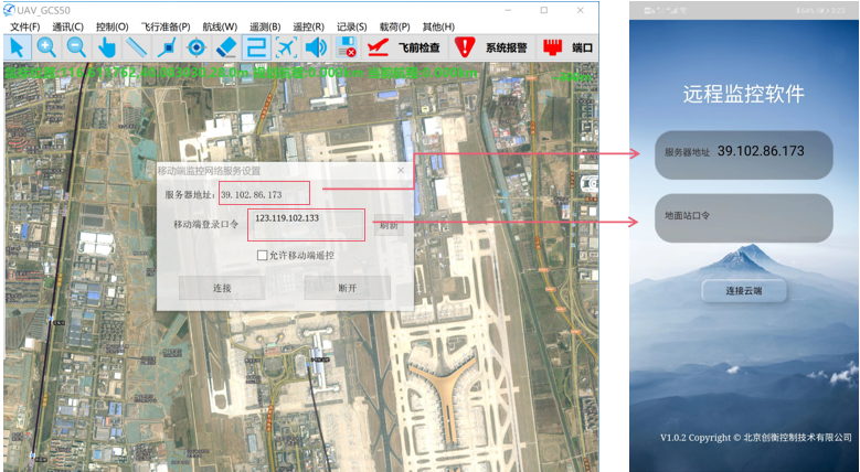
This parameter is set for GCS50 and RCS10 connection verification
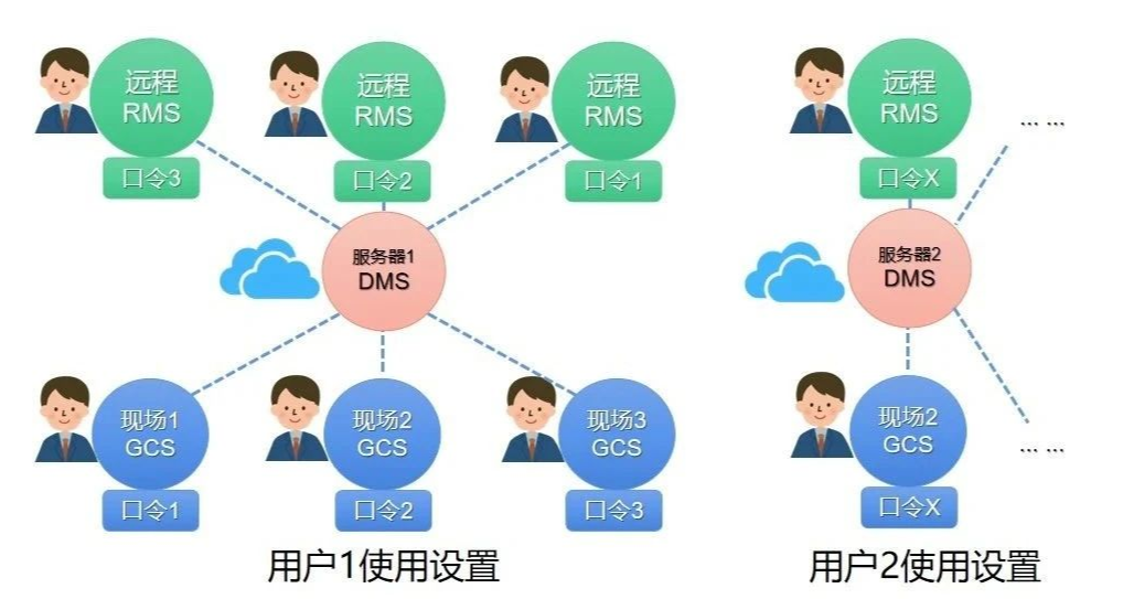
User access verification
Remote control telemetry function
It has the functions of multi-aircraft data map track display, telemetry parameter display, status alarm, flight report generation, key remote control command transmission and so on.
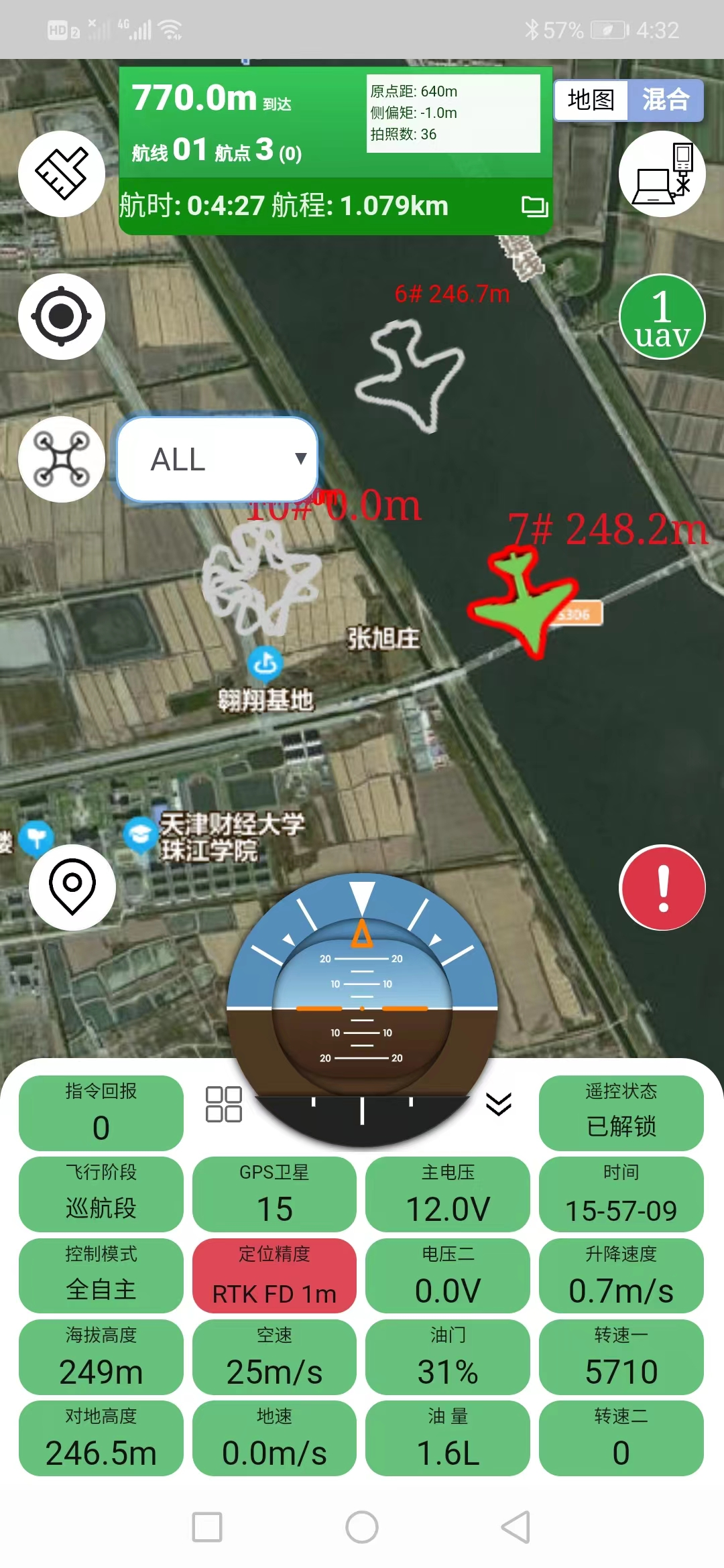
Telemetry interface
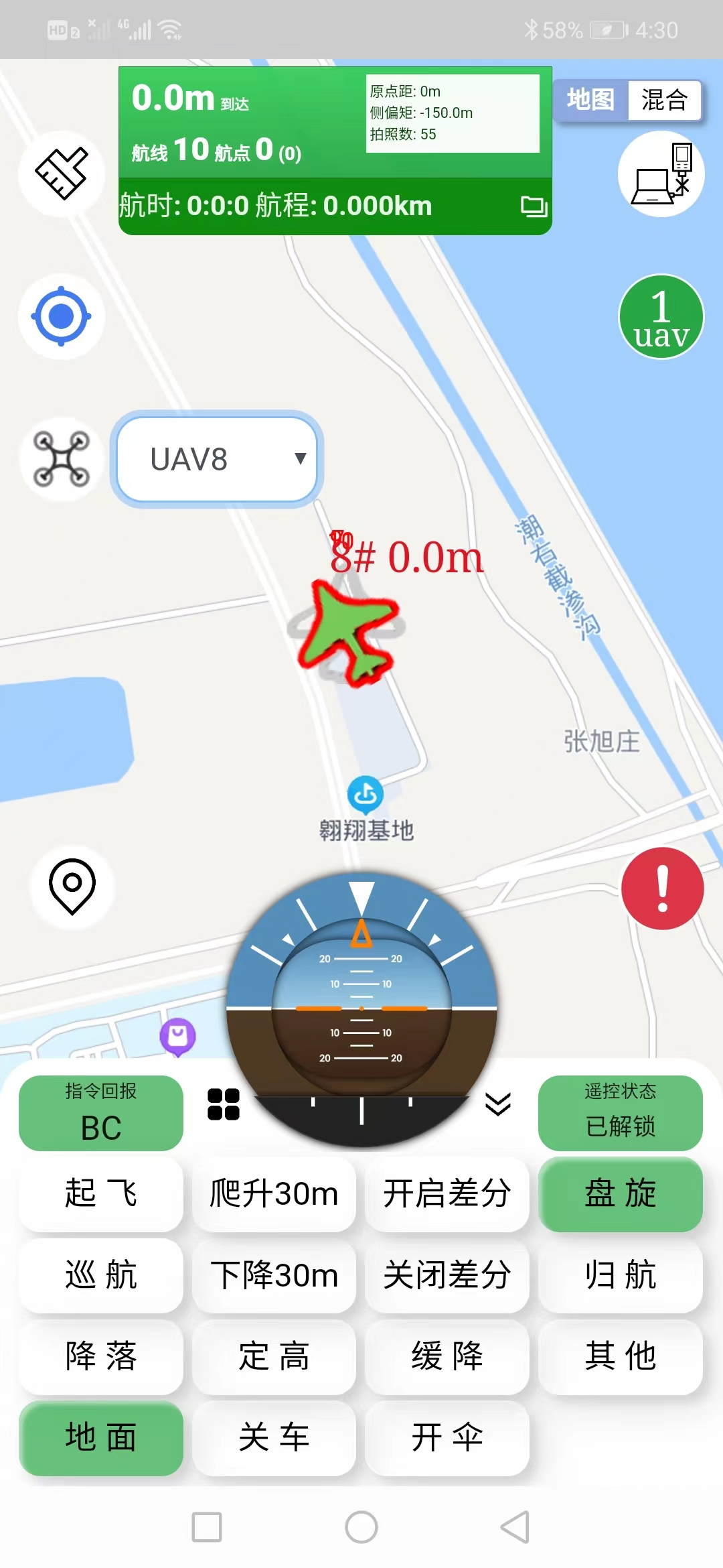
Remote control interface
Software usage video
Data management software
The data management software DMS is deployed on the server to perform data exchange between the ground control software GCS and the remote control software RMS. Users can use GCS+DMS+RMS to establish an Internet flight monitoring system or an Intranet flight monitoring system according to their needs.
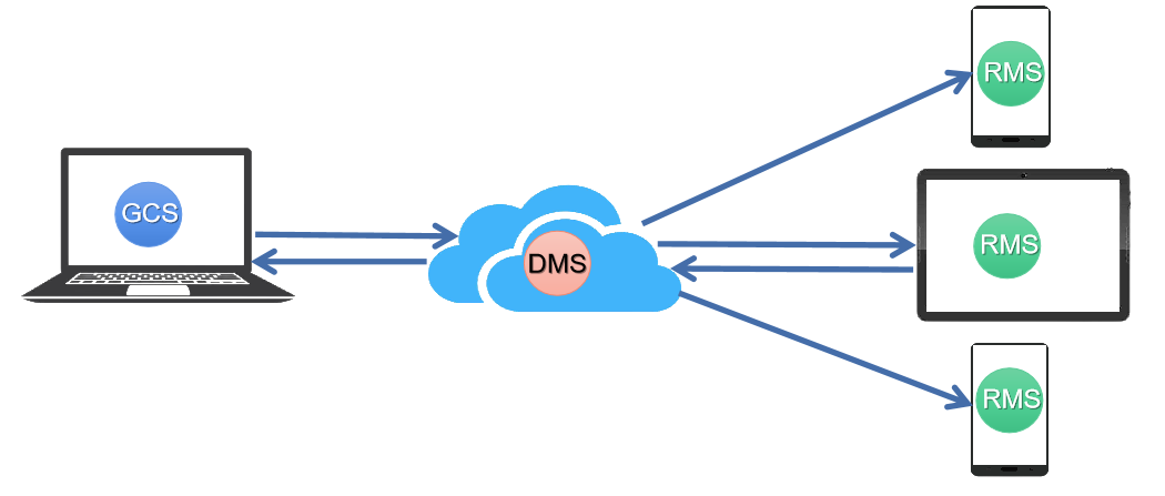
Flight monitoring system based on DMS
Flight simulation suite
Flight Simulation Toolkit,FST
Flight simulation suite FST establishes the data interaction connection between commercial flight simulation software and flight control system, and realizes UAV modeling, atmospheric condition setting, fault simulation setting, etc.
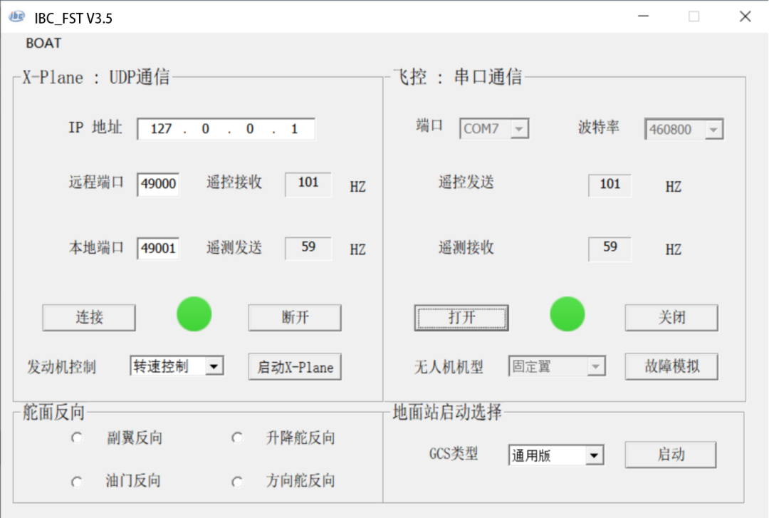
Communication interface setup
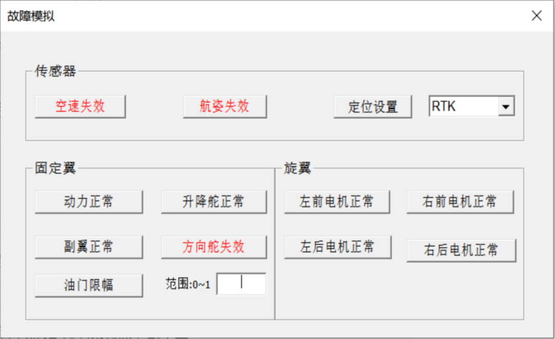
Fault simulation setting
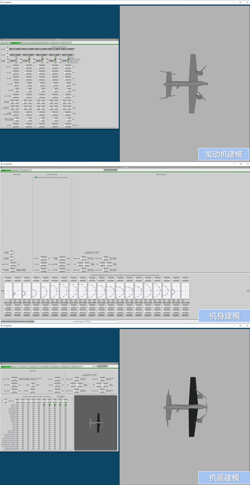
Customized modeling of the fuselage, wing and power system is carried out according to the model parameters of the customer aircraft, and full simulation verification is carried out before the flight test of the aircraft in the field to reduce the flight risk.
According to the requirements of flight simulation test conditions, the atmosphere environment is flexibly set, and the atmospheric environment parameters are obtained in real time through the network to realize the simulation flight under different environments.
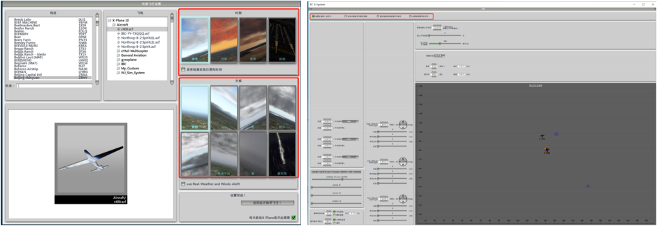
Atmospheric environment setting
Based on flight simulation suite FST, flight control computer and ground control software GCS, the semi-physical simulation training system is realized.
Semi-physical simulation training video
Digital modeling suite
Digital Modeling Toolkit,DMT
For the development of new aircraft, digital modeling is carried out to support the complete UAV dynamics, kinematics and mass characteristics model, as well as sensor error setting, wind interference injection, fault injection, etc.
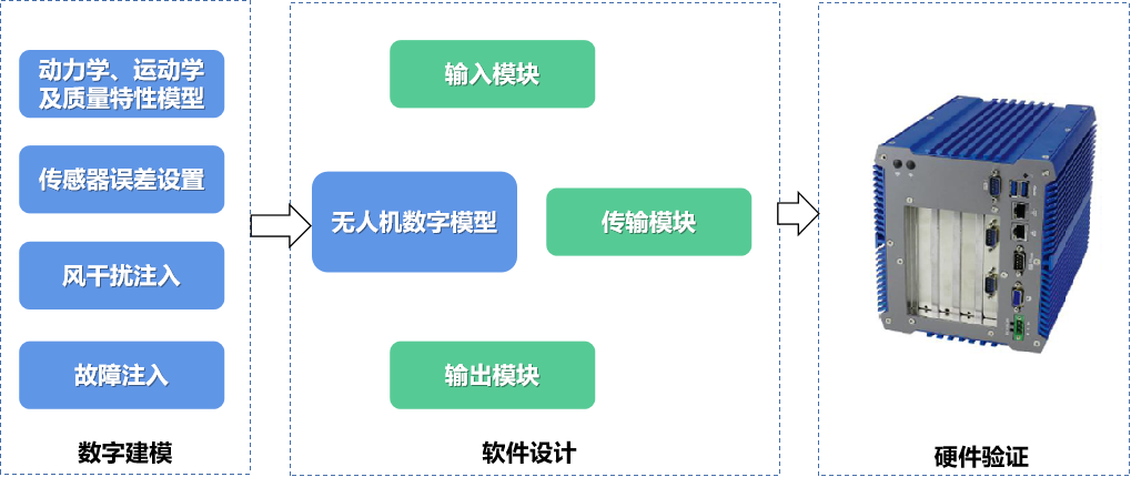
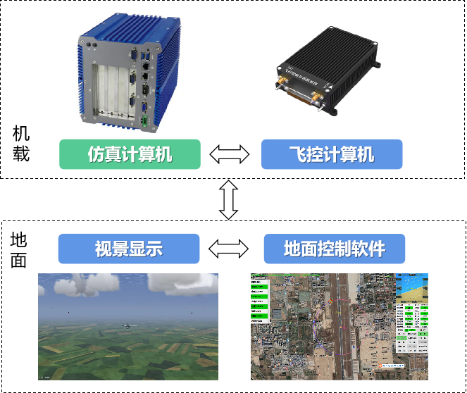
On the basis of the digital model, the input module, output module and data transmission module are established to form a digital aircraft software with complete functions, which is downloaded to the simulation computer, and constitutes a new model simulation verification system together with the flight control system, ground control software and visual software.
3D display software
3D Display Software, 3DS
Based on commercial engine for secondary development, according to customer needs, quickly build a wide range of high-fidelity 3D scenes. Support: sky/air/ground/sea scenarios, visible light/infrared /SAR imaging load simulation, thousands of kilometers of large terrain, multiple format model loading, windows/linux cross-platform.
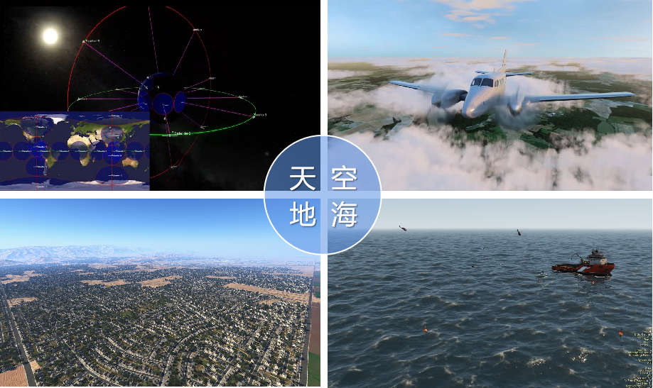
Sky/air/Earth/sea multi-scene simulation
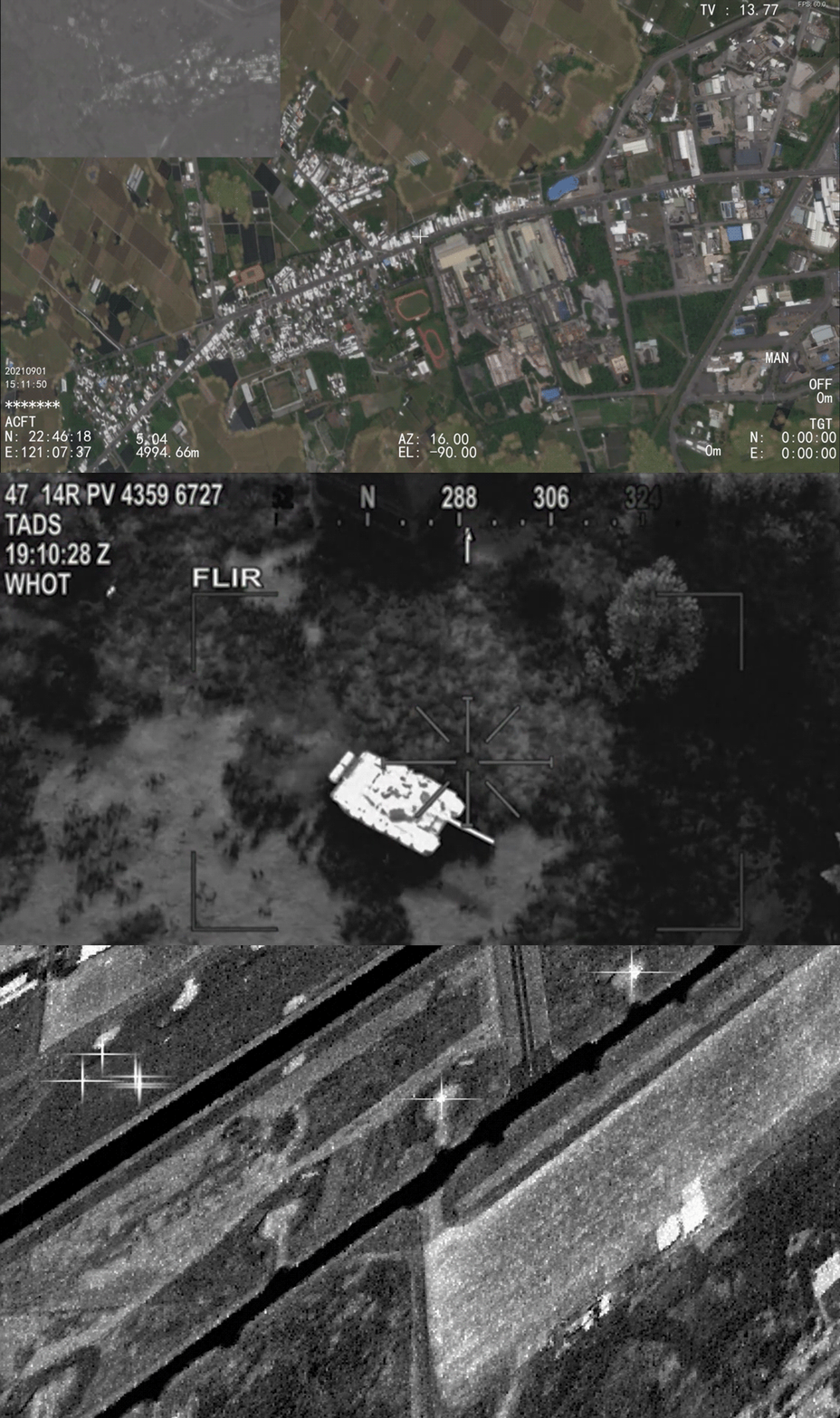
Visible/infrared /SAR imaging load simulation
Sum up
The above six software products can provide users with services for a variety of application scenarios, including: on-site flight control, remote flight command, pilot simulation training, new aircraft development modeling, three-dimensional scene display, etc.
END

Creative idea

Scan code attention

